
Trace a Garfield Street by Address
Address work in Garfield begins with the municipal assessment path, not with a claimed resident name. Use the location field to find the property, then save the situs address and the block, lot, and qualifier. The assessor result can identify an assessed owner and a mailing address, but those facts have different meanings. A trust, company, estate, or owner living elsewhere can appear on a parcel record. The aim is to build an address trail that can be checked in the next record system.
- Search the Garfield assessment record by location. Record the situs, owner field, mailing address if shown, and block, lot, and qualifier.
- Open the same area in the Bergen County Parcel Viewer. Click the target parcel and the adjoining polygons to compare parcel context and identifiers.
- Use New Jersey's individual voter status portal only for its official status purpose. A ZIP or street is not a verified public browse filter, and protected voter records may be withheld.
- Search Bergen BrowserView with the owner name, town, block or lot where available, and deed details. Follow the legal description rather than relying on a street number alone.
- For an older address, ask the Garfield Public Library or Historical Society about maps, the street-name files, and address-organized or telephone directories. Compare an old map label before deciding that a number vanished.
That sequence preserves the boundary between a public ownership record and a claim about current occupancy. It also makes a Garfield street directory useful for family history, estate questions, and property curiosity without turning a parcel into a household profile.
Garfield Assessment Fields by Street
The public assessment form is organized around Garfield district 0200. It first asks for database, county, district, search format, output format, and items per page. Its location field is the practical entry point for an address. The exact choices inside several dropdowns were not exposed during inspection, so they should be confirmed in the live form rather than guessed. A returned record may show assessments and sale-related data, but the database warns that its data are not warranted and that recent SR1A sales can still be a working file.
| Assessment control | Type | Required | Garfield use |
|---|---|---|---|
| Database | Dropdown | Required step | Select the assessment or SR1A database; options were not text-exposed. |
| County | Dropdown | Required step | Select Bergen. |
| District | Dropdown | Required step | Garfield is district 0200. |
| Search and output format | Dropdowns | Required step | Portal-controlled options were not verified in text inspection. |
| Location | Text | Optional | Street or property-location query; wildcard rules were not located. |
| Owner Name | Text | Optional | Searches the recorded owner field. |
| Block, Lot, Qualifier | Text fields | Optional | Use together to pin down a parcel or unit. |
| Process | Button | Not applicable | Submits the selected search. |
Expect identifiers such as property location, owner, mailing address when maintained, block, lot, qualifier, assessment components, classification, exemption or deduction indicators, and tax or SR1A sale fields. An individual Garfield parcel card was not opened during the source inspection, so the field list is a guide to the system rather than a promise that every result will contain every field.
Map Garfield Parcels Along the Block
Garfield's compact street grid makes the parcel map a useful second check after the assessment search. The county GIS department maintains the applications, while the public viewer was labeled as updated in May 2022. Its text interface did not expose exact search controls, layer names, or a radius tool. The reliable method is simple: locate the street segment, select the target parcel, note the available identifier, then select the parcels sharing a boundary or facing it. Parcel lines show map context, not a survey and not proof that a named person lives there.
Note: Map controls and available owner links need live-screen confirmation before a result is treated as a searchable feature.
Garfield Permits Mark Address Changes
A permit trail can help date work at a building, but it does not establish who occupied it. Garfield's Building Department and related municipal functions handle permits, certificates, inspections, and property-condition routes. FastTrack accepts online applications and payment for building permits, certificates of occupancy, dwelling certificates, and listed municipal licenses. Its inspected public landing page did not expose a historical address-search screen. For older or unposted records, use the appropriate department, its counter or an OPRA request that names the address and specific record type.
The Garfield FastTrack application portal shows the current online submission channel.
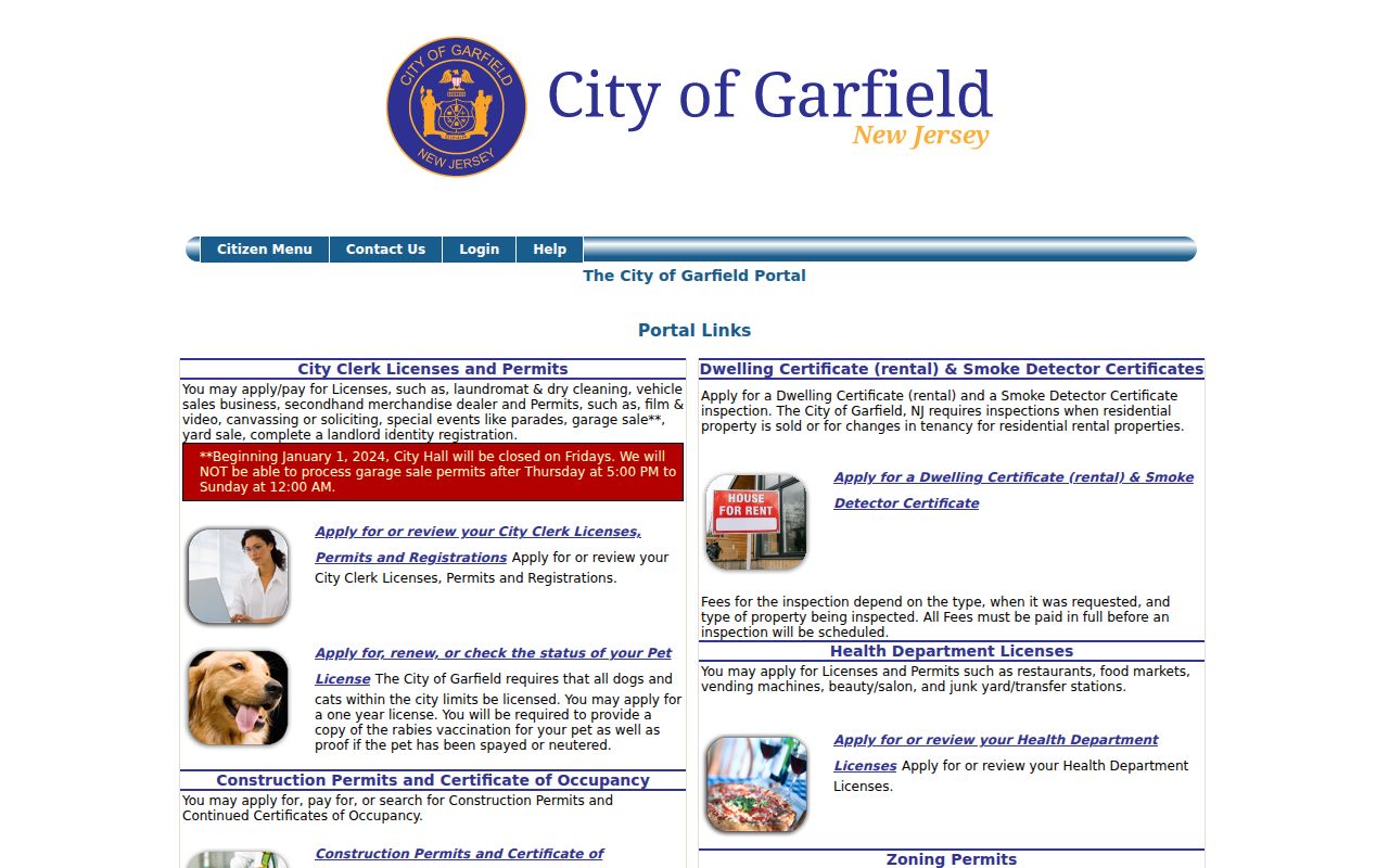
When a permit, inspection, or certificate is relevant, compare its site address and date with the assessor and deed record. An applicant or permit contact may be an owner, contractor, or other project contact, not a resident.
Follow Garfield Deeds Through BrowserView
Bergen County Clerk records deeds, mortgages, assignments, discharges, liens, tax-sale certificates, plats, and other real-estate instruments. The online public search states coverage from January 1, 1970 to the present. That date marks the web search, not the beginning of the county collection, which the Clerk describes as more than 300 years old. BrowserView is a practical route when the advanced screen has browser or ClickOnce compatibility trouble.
Search the Bergen Land Records BrowserView by town, date range, party name, lot and block, document type, instrument number, book and page, or legal description as the record supports.
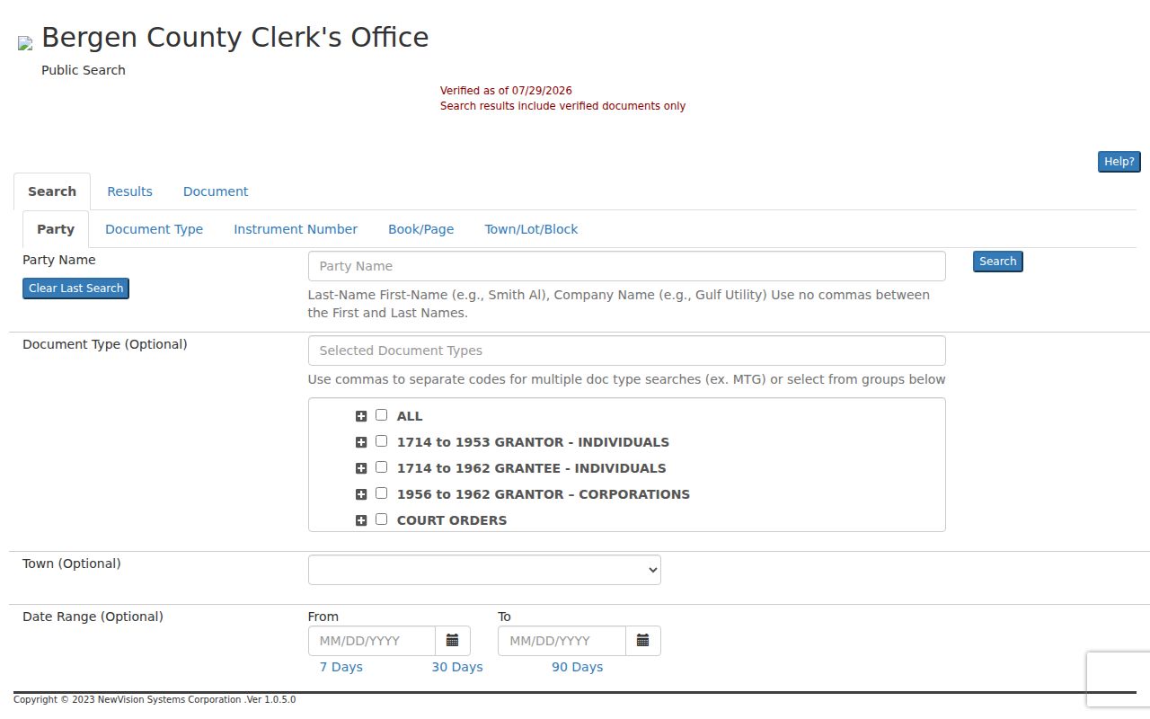
A result can include an indexed party, document type, recording date, instrument number, book or page, town, consideration, page count, linked documents, and viewer or print controls. Not every historic instrument supplies every field. The Clerk advises searchers to try spelling variants. For a backward chain, take the current acquisition deed, identify its grantor, and search that seller as an earlier grantee for the same legal description.
Garfield Address Records Compared
Each address-keyed source answers a different street question. Combining them is more reliable than asking one record to do every job. The coverage below also shows the documented fallback when a portal does not offer a public browse screen.
| Address record | Custodian | Street evidence | Access channel |
|---|---|---|---|
| Assessment and tax roll | Garfield Assessor | Assessed owner, situs, mailing address if present, block, lot, assessment values, classifications, and exemptions. | Online district 0200 search; assessor or property-card request. |
| Parcel map | Bergen County GIS | Parcel shape, adjacent parcels, and available identifiers or layers. | Public viewer; GIS phone or email support. |
| Deed and mortgage index | Bergen County Clerk | Transfer parties, legal description, instruments, liens, mortgages, and plat references. | Web index from 1970; counter, archive, or microfilm for earlier work. |
| Building and UCC permits | Garfield Building Department | Site, project type, applicant or owner, inspection dates, and certificates. | FastTrack or office; no public historical index located. |
| Property maintenance | Garfield Property Maintenance | Address inspection or violation evidence where disclosable. | City office or targeted OPRA request; no public search located. |
| Historical directories and maps | Library, Historical Society, and State Library | Past address, business, occupation, street names, and map context. | Shelf, microfilm, arranged archival access, or online map collection. |
Garfield Parcel Terms That Matter
Street numbers are helpful starting points, but county and municipal systems rely on more durable identifiers. These terms prevent a common error: treating a mailing label or map shape as the same thing as a legal property identity.
- Parcel
- A mapped property unit used in assessment and GIS work. It can be identified by municipality, block, lot, and qualifier.
- Situs address
- The physical property location carried in the assessment system. It differs from the address where tax mail is delivered.
- Plat
- A recorded map or subdivision plan that can appear among the Clerk's land instruments and helps describe property boundaries.
- Criss-cross directory
- An address-organized directory that can help place a past household or business at a street address. No Garfield-specific run was verified, so ask the library or State Library about available address-organized volumes.
The legal description in a deed may instead use block and lot or metes and bounds. Match it against the parcel identifiers when an old street address is absent or has changed.
Garfield Voter Status Has Boundaries
New Jersey's voter route is an individual registration-status tool, not a confirmed street-wide directory. The automated inspection returned a 403 response, so its live fields and result display should not be inferred. The surrounding election material shows that registration facts can include a domicile address, mailing address, party affiliation, election district or ward, status, and voter identifier. Candidate selections remain secret.
Bergen's Superintendent of Elections and Commissioner of Registration keeps registration, address-change, and poll-book functions. A full electronic voter list may be available to a voter through a county request under the state's listed route and reproduction-cost limit, but signatures, identity numbers, and protected addresses are excluded. ACP and Daniel's Law protections can also suppress information. A missing result is not proof that a person is unregistered or absent from an address.
Garfield Street Owners Are Not Households
A useful caution. A name attached to a Garfield address does not prove that every person at the address is known. Assessment data identify an assessed owner, deeds identify parties to a recorded transfer, and a permit may name a project contact. A mailing address can be outside the city. A ZIP result is a delivery check, not proof that a person or company is at an address. Cross-check the narrow question with the custodian that holds the relevant record.
Household members, utility customers, unlisted phone users, protected participants, relationship details, and current occupancy are not established by the address records above. Keep the record and the conclusion at the same level.
Note: Daniel's Law redactions may affect public address and name displays, so absence in a result requires care.
Garfield Street Names Preserve History
Garfield sits at the Passaic and Saddle River junction in a dense 2.08-square-mile street grid. The official street index is useful for normalizing a current spelling before an address search. Historic records can use a different locality label. The Jewell Street area was called Robertsford, and Veterans Bridge connecting Ackerman Avenue in Clifton toward Outwater Lane was once Robertsford Bridge. Outwater Lane and River Drive also appear in the city's industrial and riverfront history.
The Historical Society finding aid identifies a Street Names: Origins and Changes file, maps from 1920, 1944, and 1958, an assessment map, and a River Drive boundary survey. No Garfield-wide renumbering year or conversion table was verified. Treat the maps and street-name file as a method for reconciling an old label, not as evidence that every unfamiliar number was renumbered.
Garfield Street Directory Before the Web
When the online deed trail stops at 1970, the next channel is not guesswork. Land Records Management at One Bergen County Plaza can route older books, indexes, images, and copy questions. State Archives holds microfilm copies of New Jersey county deeds through 1900, while county originals remain with their custodians. The Garfield Public Library and Historical Society provide an additional local route for maps, directories, newspapers, and finding-aid material. The Library of Congress Sanborn record also places Garfield on sheets 24 through 41 of a 1917 volume revised in 1951.
Address-organized historical volumes may add a past household or business clue, but title history still belongs in the deed chain. For the collection route rather than the current parcel workflow, consult the Garfield City Directories.
Limits of a Garfield Street Directory
A careful Garfield street directory can connect a street address to a parcel, an assessed owner, an instrument, a mapped setting, or a dated building record. It cannot convert those pieces into a current household roster. Assessment values are not independent proof of market value, GIS boundaries are not surveys, and a deed index is not a title opinion. Exact questions should go to the Garfield Assessor, Building Department, Property Maintenance office, Bergen County Clerk, or election custodian that owns the record.
For a current property question, confirm the result with the holding office. For a historical address, preserve the source date and compare names, legal descriptions, and map labels before reaching a conclusion.